History
Tennessee River History
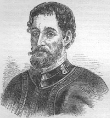
Hernando De Soto
Historians believe that the first people to have lived in the Tennessee River Valley arrived at least 8,000 years ago, based on excavations at Russell Cave in northern Alabama. The river was also home to the ancient Mound Builders who settled into the watershed more than 1,000 years ago. In 1540, Hernando De Soto’s Spanish expedition reached the Tennessee River exploring from the present location of Chattanooga, TN to the current location of Guntersville, AL. De Soto and his men set up camp on Shoal Creek during the winter of 1540 near the present location of Davy Crockett State Park in Lawrenceburg, TN. De Soto’s expedition was the first recorded in the watershed by European explorers.
For the next two hundred years Native American tribes, including the Cherokee, Chickasaw, and Creek, remained virtually undisturbed in the Tennessee River watershed. Most of their towns were on the river and Native American life in the valley was tied strongly to the river. In the 1700s, the French had established several trading posts along the river but lost them to the English after the French defeat in the French and Indian War of 1760. From 1760 to 1820, the English and early Americans began establishing new settlements along the River in Knoxville, Guntersville, Decatur, Florence, Sheffield, Tuscumbia and Paducah. By 1791, Knoxville had become the capital of the territory. Conflicts occurred between Native Americans and the new European Americans as both peoples sought to locate their settlements near the water. In the winter of 1837, the US Federal Government forced seventeen thousand Cherokee to move west in what became known as the Trail of Tears.
Civil War – Tennessee Valley Authority

Battle of Shiloh, April 6 - 7, 1862
During the Civil War (1861-1865) the Tennessee River was a key target for Union soldiers as they advanced toward the western part of the Confederacy. Major battles were fought in towns on the River including Chattanooga, Knoxville, and Shiloh, TN. Shiloh was one of the bloodiest battles of the Civil War, in the end more than 23,000 American soldiers died.
On May 18, 1933, President Franklin Delano Roosevelt signed the Tennessee Valley Authority Act creating the TVA. The Tennessee Valley Authority was designed to modernize the region, using experts and electricity to combat problems in the region. A primary part of the plan was to create electricty and provide flood relief by constructing a series of dams throughout the Tennessee River and its tributaries. In 1933, construction began on the first massive dam, Norris Dam on the Clinch River, and was completed in 1936. The building of Norris Dam and the changes it brought to the region inspired films, books, stage plays, and songs. By 1945, the Tennessee Valley Authority had completed a 650-mile (1,050-kilometer) navigation channel the length of the Tennessee River and had become the nation’s largest electricity supplier. In 1957, the construction of Chickamauga dam helped prevent Chattanooga from being covered by one of the largest floods in the river’s history. The 1960s were years of unprecedented economic growth in the Tennessee Valley. Electric rates were among the nation’s lowest and stayed low as TVA brought larger, more efficient generating units into service.
Cumberland River History

Flooding in downtown Nashville, Tennessee in May 2010
The explorer Thomas Walker of Virginia in 1758 named the river, but whether for the Duke of Cumberland or the English county of Cumberland is not known.
The Cumberland River was called Wasioto by the Shawnee Native Americans, who lived in this area. French traders called it the Riviere des Chaouanons, or “River of the Shawnee” for this association. The river was also known as the Shawnee River (or Shawanoe River) for years after Walker’s trip.
Important first as a passage for hunters and settlers, the Cumberland River also supported later riverboat trade, which traveled to the Ohio and Mississippi rivers. Villages, towns, and cities were located at landing points along its banks. Through the middle of the 19th century, settlers depended on rivers as the primary transportation routes for trading and travel.
In more recent history, a number of severe floods have struck various regions that the river flows through. In April 1977, Harlan, Kentucky, and many surrounding communities were inundated with floodwaters, destroying most of the homes and businesses within the floodplain of the river. This event led to the building of the Martins Fork Dam for flood control and the diversion of the Clover Fork around the city of Harlan. In addition, the river was diverted through a mountain cut in Loyall, Kentucky.
In late April and early May 2010, due to the 2010 Tennessee floods, the river overflowed its banks and flooded Nashville and Clarksville, Tennessee. The downtown area was ordered to evacuate.